Boston, Nov. 19, 2015, — On Friday, the Norman B. Leventhal Map Center’s newest exhibition, We Are One: Mapping America’s Road from Revolution to Independence welcomed its 100,000th visitor since opening in May at the Boston Public Library. The exhibition is the most successful in the Map Center’s history, and has been visited by individuals from 46 states and 51 countries. We Are One closes its doors on November 29 before moving to Colonial Williamsburg in 2016.

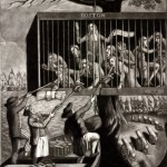
A drawing from 1778 in the exhibit(from bpl.org).
“This exhibition has succeeded beyond our wildest expectations,” said Jan Spitz, executive director of the Leventhal Map Center. “Tourists, visitors, scholars and regular Bostonians have flocked here over the last six months, and I think that’s a testament to the rarity and incredible historical value of the items in the collection.”
The 100,000th visitor was Jeremy Asprey of Dorchester. He said he has an interest in history and maps and visits the Map Center’s website regularly, which was where he learned about the exhibition. As the 100,000th visitor he received a free We Are One catalog.
We Are One is located on the first floor of the Boston Public Library’s Central Library in Copley Square in the McKim building, which faces Dartmouth Street. The exhibition is open during the following hours: Monday–Thursday: 10 a.m.–7 p.m.; Friday–Saturday: 10 a.m.–5 p.m.; and Sunday: 1–5 p.m. Over Thanksgiving weekend, We Are One is open from 9-5 on Friday and Saturday. The final day will be Sunday, November 29 from 1- 5 pm. Visit our exhibition website (http://maps.bpl.org/WeAreOne).
We Are One explores the tumultuous events that led thirteen colonies to forge a new nation and commemorates the 250th anniversary of American colonial resistance to Britain’s 1765 Stamp Act, a pivotal moment in the chain of events that led to revolution. The exhibition features 60 maps and 40 prints, paintings, and objects selected from 20 partner institutions, including the British Library, Library of Congress, and other public and private collections, telling the story of our nation’s founding.
We Are One takes its title from Benjamin Franklin’s early design for a note of American currency containing the phrase “We Are One.” This presaged the words “E Pluribus Unum” found on the seal of the United States and on all U.S. coins. Using geographic and cartographic perspectives, the exhibition traces the American story from the strife of the French and Indian War to the creation of a new national government and the founding of Washington, D.C. as its home. Exhibited maps and graphics show America’s early status as a British possession: thirteen colonies in a larger trans-Atlantic empire. During and after the French and Indian War, protection of those thirteen colonies exhausted Britain economically and politically and led Parliament to pass unpopular taxes and restrictions on her American colonial subjects. The Stamp Act, the Tea Tax, and limits on colonial trade and industry incited protests and riots in Boston, as contemporaneous portrayals in the exhibition show.
When tensions between Britain and her American colonies erupted into war, cartographers and other witnesses depicted military campaigns, battles, and their settings. At a time when photography was nonexistent and art was romantic and stylized, these maps and drawings provide the most accurate pictorial representations of the North American colonies and bring the long, bloody struggle for independence to life.
We Are One also shows how, in the aftermath of the Revolution, America took stock of her new geography with surveys and maps. During this period, the Founders struggled to craft a new national government that would confederate thirteen colonies with different economic interests and cultures. European maps reflect their success by recognizing America’s triumphant new status of nationhood and her expanding territory.
The Norman B. Leventhal Map Center is ranked among the top 10 map centers in the United States for the size of its collection, the significance of its historic (pre-1900) material, and its advanced digitization program. It is unique among the major collections because it also combines these features with exceptional educational and teacher training programs to advance geographic literacy among students in grades K-12 and enhance the teaching of subjects from history to mathematics to language arts. The collection is also the second largest in the country located in a public library, ensuring unlimited access to these invaluable resources for scholars, educators, and the general public. The Leventhal Map Center, created in 2004, is a nonprofit organization established as a public-private partnership between the Boston Public Library and philanthropist Norman Leventhal. Its mission is to use the Boston Public Library’s permanent collection of 200,000 maps and 5,000 atlases and a select group of rare maps collected by Mr. Leventhal for the enjoyment and education of all through exhibitions, educational programs, and a website that includes thousands of digitized maps at maps.bpl.org. The map collection is global in scope, dating from the 15th century to the present, with a particular strength in maps and atlases of Boston, Massachusetts, and New England.
Boston Public Library has a Central Library, twenty-four branches, map center, business library, and a website filled with digital content and services. Established in 1848, the Boston Public Library has pioneered public library service in America. It was the first large free municipal library in the United States, the first public library to lend books, the first to have a branch library, and the first to have a children’s room. Each year, the Boston Public Library hosts thousands of programs and serves millions of people. All of its programs and exhibitions are free and open to the public. At the Boston Public Library, books are just the beginning. To learn more, please visit www.bpl.org.


